Water Resources
Houston Stronger

Today, Houston Stronger still works to find solutions to regional flood control, with its most recent work being a $61.55 billion flood control plan. That plan was passed during the 86th Legistlative Session and encompasses 12 independent projects that will cover the entire Houston region and more. Houston Stronger and the many businesses from all over the region that make it up have worked diligently to ensure these plans include projects to help create a safer future for us all.
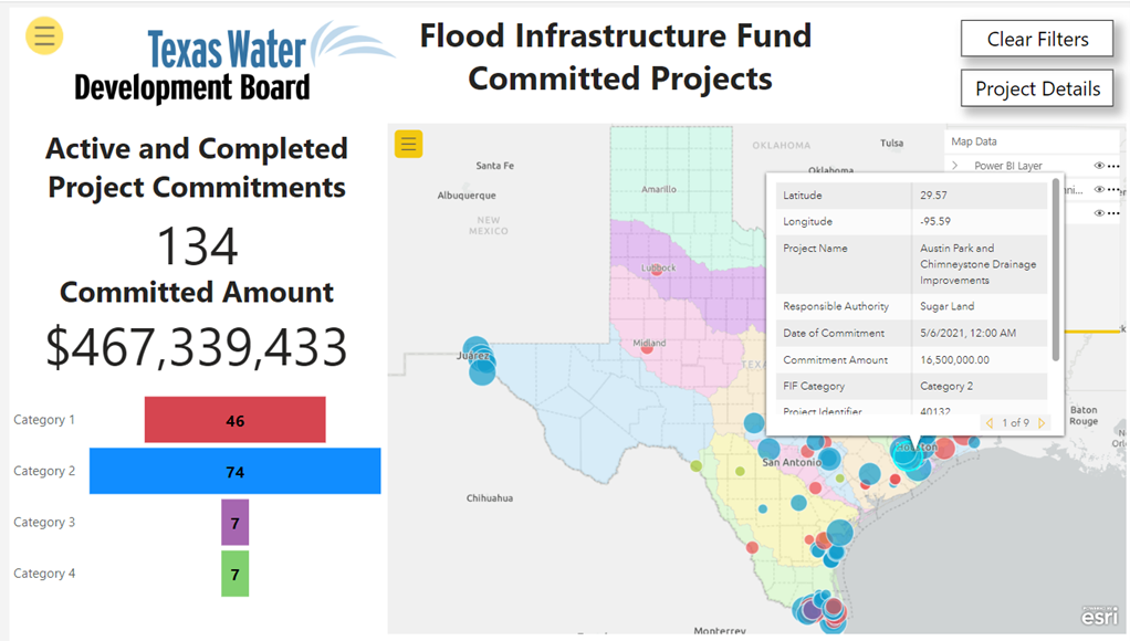
$5 Billion for Flood Infrastructure Fund
One of our 2023 legislative objectives is to win support for an additional appropriation of $5 Billion for the Flood Infrastructure Fund (FIF) and continued funding for the Regional Planning Groups. Our slogan is Five for the FIF. $5B is based on the initial estimates of the 15 Regional Flood Plans submitted to the Texas Water Development Board in August 2022 as the first step in the development of a state flood plan. Those estimates are in the $40-50 billion range and our requested funding appropriation is 10% of that amount. If approved, these funds will be used to fund previously submitted and approved flood improvement projects from the first appropriation of $770 million, which is now depleted, and will fund projects in the new state flood plan which is to be adopted in 2024.
Buffalo Bayou Community Plan
Since Houston was founded on its banks, Buffalo Bayou watershed has been critical to the Texas Gulf Coast. After catastrophic flooding in 1929 and 1935, the U.S. Army Corps of Engineers (the Corps) produced a flood mitigation plan for Buffalo Bayou in 1940, which included Barker and Addicks Reservoirs. The other elements of the Corps’ 1940 plan were never built, leaving the Buffalo Bayou watershed prone to chronic flooding. To avoid flooding homes during a Harvey-size storm and complete its plan, the Corps must find a way to convey additional flood waters from the reservoirs to Galveston Bay. Adding flood water storage upstream and within the reservoirs helps keep the water out of homes and businesses.
The Corps’ Interim Report for the Buffalo Bayou and Tributaries Resilience Study favors two solutions, Alternative 2, channelizing Buffalo Bayou, and Alternative 6, constructing a reservoir on the Katy Prairie. The community
opposes these alternatives. Community opposition to channelization of Buffalo Bayou has only grown since Terry Hershey and George H. W. Bush opposed it more than 60 years ago. A massive reservoir on the Katy Prairie would destroy a critical ecosystem and face fierce community opposition. If the Corps seeks effective flooding solutions and achieving community support, the Buffalo Bayou Community Plan provides a road map that will achieve these dual purposes.
The Buffalo Bayou Community Plan is formulated with the following goals:
• Contain and convey the storm events similar in magnitude to Hurricane Harvey (2017).
• Contain flood waters within the boundaries of federally owned lands for Barker and Addicks Reservoirs.
• Add conveyance downstream of Barker and Addicks Reservoirs without channelizing Buffalo Bayou.
• Reduce flooding conditions in Buffalo Bayou watershed downstream of the reservoirs resulting from local rainfall.
• Minimize environmental impacts and enhance long term environmental benefits.
• Have broad and prolonged community support from a diverse group of stakeholders.
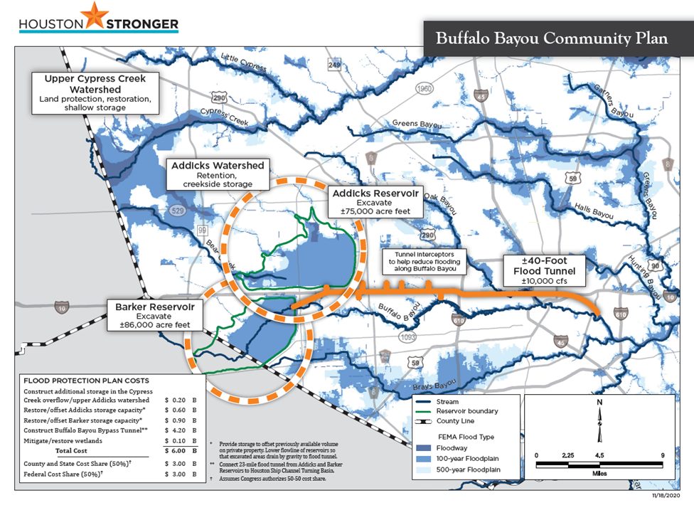
The Buffalo Bayou Community Plan is comprised of four components. The components of this plan are concepts that aim to accomplish the goals stated above but require additional study.
Component 1
Construct a ±40-foot diameter tunnel capable of conveying ±10,000 cubic‑feet per second of flood water from Barker and Addicks Reservoirs to the Houston Ship Channel. Tunnel interceptors along IH 10 and Buffalo Bayou will significantly increase flood protection for Harvey-type events. A force main and expansion at the City of Houston’s East Water Purification Plant can create a new water source and funding for the tunnel without adding any additional cost to the project.
Component 2
Provide ±86,000 acre-feet of compensating storage within Barker Reservoir to offset the loss of volume on private property. Using fill material to create topography can add ecological and recreational value and reduce transportation costs.
Component 3
Provide ±75,000 acre-feet of compensating storage within Addicks Reservoir to offset the loss of volume on private property. Similar benefits and opportunities are available in Addicks Reservoir.
Component 4
Provide land protection and restoration, shallow storage areas in the upper Cypress Creek watershed, and retention and creekside storage in upper Addicks watershed.
Buffalo Bayou and Tributaries Resiliency Study Documents
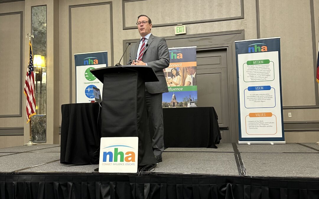
Houston Airports Director Joins NHA at Annual Membership Luncheon
Houston Airports Director of Aviation, Jim Szczesniak, A.A.E., joined NHA on November 12th for the Annual Membership Luncheon & Board Installation. With more than two decades of management experience in both the public and private sector, Jim is responsible for...

NHA Debuts its 1st Strategic Flood Reduction Priorities Document
NHA has officially unveiled the inaugural Strategic Flood Reduction Priorities (SFRP) document with a wonderful evening reception at the East Aldine Management District Ampitheatre. We are so proud to share this project with you all, which has...

IAH, City of Houston and Local Partners Present $20,000 to Anti-Human Trafficking Organizations
Earlier this year, on April 20th, 2024, the Houston Airport System hosted a community prevention initiative to raise awareness about human trafficking, emphasizing the importance of knowledge in rescuing victims and preventing future occurrences...

